NIAGARAAERIAL MEDIA
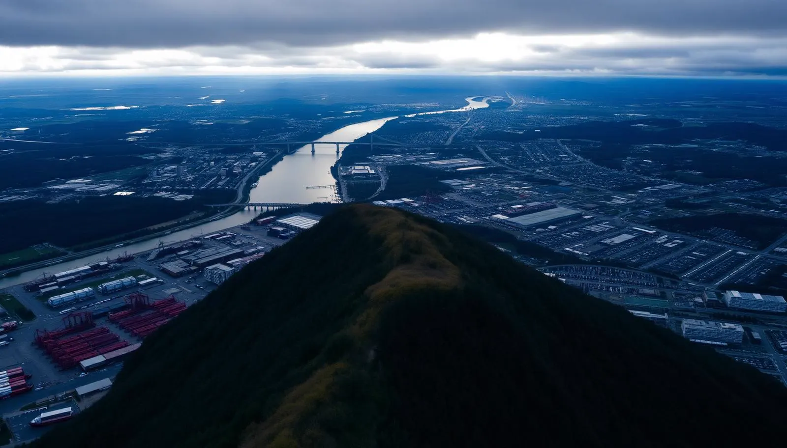
Aerial photograph of the Niagara Escarpment above Hamilton Harbour and the industrial waterfront, Ontario
Service Area

Drone Photography in Hamilton

Industrial, construction, and commercial aerial work in the most complex airspace we fly, planned by a pilot who reads the charts before quoting the job.

Advanced RPAS Certified·CYHM controlled airspace authorization·Site-specific flight plans

The hardest city in our service area, and the one we plan hardest for

Hamilton is not one market. The harbour and the steel lands are heavy industry with active stacks, rail, and port traffic. The lower city is dense residential grid. Above the escarpment, the Mountain is suburban. Dundas and Ancaster are older, leafier, and tucked into valleys. Stoney Creek runs out toward the fruit belt. Each one needs a different flight plan, and the airspace over all of it is the busiest we work in.

The escarpment is the defining feature and the most misunderstood. A property or site at the brow is not simply higher: it changes your legal altitude reference, the wind behaves differently over the edge, and the difference between a good frame and a wasted trip is whether the pilot understood that before arriving. The waterfalls in the Dundas and Ancaster valleys sit in conservation land with their own access rules.

Because of all that, most of our Hamilton work is commercial rather than residential. Contractors, property managers, industrial operators, and marketing teams want documentation that will hold up: consistent altitude, repeatable angles, dated files, and a pilot who can produce a certificate number and a flight authorization when a site manager or insurer asks for one.

What we shoot in Hamilton

Industrial and facility documentation

Roof surveys, stack and structure condition imagery, yard and stockpile overviews, and site-wide reference sets for facilities in the north-end industrial belt and along the Burlington Street corridor. This is our lead commercial service in Hamilton. We supply the flight authorization and certificate details your safety department will ask for, and we work to site induction requirements.

Construction progress and development marketing

Monthly or milestone-based progress sets flown from the same GPS points at the same altitude and heading each visit, so the sequence is genuinely comparable rather than a pile of unrelated pretty pictures. Useful for lender reporting, trade coordination, and pre-sale marketing on Mountain and downtown developments.

Property, when the setting carries the value

Brow properties with the city and harbour behind them, Ancaster and Dundas homes on wooded lots, and Stoney Creek acreage. Listing aerials and the occasional wedding at an escarpment venue round out the work, but Hamilton is a commercial city for us.

Hamilton airspace: the most complex we fly, and why that matters to you

If you only read one airspace section on this site, read this one. Hamilton is where a drone booking most often falls apart on the day, and it is almost always for reasons that were predictable a week earlier.

John C. Munro Hamilton International Airport (CYHM) is a certified airport with genuine traffic: scheduled passenger service, a large overnight cargo operation, and flight training. It sits on the Mountain south of the city and carries a substantial geozone plus controlled airspace above it. A meaningful part of upper Hamilton, Mount Hope, Glanbrook, and the eastern Mountain falls inside that footprint. A Basic-certified pilot cannot legally fly there. Full stop.

Layered on top of that: the harbour and steel lands have their own operational hazards, including active industrial plumes that will destroy a flight plan and, in some cases, the aircraft. There is helicopter and air-ambulance traffic serving the hospitals. The escarpment edge produces mechanical turbulence and rotor on windy days that a small aircraft feels immediately. Conservation Halton and Hamilton Conservation Authority lands around Webster's, Tews, Sherman, and Albion Falls restrict launching and landing on their property.

Our process for every Hamilton job is the same. We take the exact address or site coordinates, check the CYHM geozone and controlled airspace boundary against it, review current notices, file for authorization through NAV CANADA's NAV Drone system where it is required, and confirm the date only once we know the flight is legal. We hold an Advanced RPAS Pilot Certificate with registered aircraft, which is the qualification that makes that request possible in the first place.

For industrial clients we can supply the authorization reference, pilot certificate number, and aircraft registration in advance for your contractor pre-qualification file. For Mountain and Mount Hope sites, give us a week where you can. Same-week bookings are often fine in the lower city, Dundas, and Ancaster.

Areas we cover in Hamilton

  • Hamilton Harbour and the north-end industrial belt
  • Downtown and the Durand district
  • Westdale and McMaster
  • Dundas and the Dundas Valley
  • Ancaster
  • Stoney Creek and Winona
  • The escarpment brow and Mountain access roads
  • Mount Hope and Glanbrook
  • Waterdown and Flamborough
  • Locke Street and Kirkendall
  • Confederation Beach and the eastern shoreline
  • Red Hill and Albion Falls area

Common questions

In many cases yes, with authorization. CYHM is a certified airport with a substantial geozone and controlled airspace above it. We hold an Advanced RPAS certificate and file through NAV Drone before confirming the date. Sites on the Mountain, in Mount Hope, and in Glanbrook need the most lead time.
Yes. We can provide the pilot certificate number, aircraft registration, and the flight authorization reference in advance for contractor pre-qualification, and we follow site induction and PPE requirements on arrival.
We record the launch coordinates, altitude, and heading on the first visit and repeat them exactly on every return flight, so the resulting set compares frame to frame across months. Files are delivered dated and organized by visit.
We can shoot in the general area, but we do not launch or land on conservation authority property without their permission, and some falls sit in restricted or heavily visited areas. We will tell you which specific location is workable before booking.
It can. Active plumes and poor visibility near the steel lands will change our approach direction or push the flight to a different wind day. We plan around it rather than flying an aircraft through it.
Pricing
Every Quote is Free

Final pricing depends on property size, duration, and deliverables. We respond within one business day.

Get a Hamilton Quote

Ready to see your Hamilton property from above?

Every quote is free. We respond within one business day.

Get a Free Quote